Date:
January, 1970
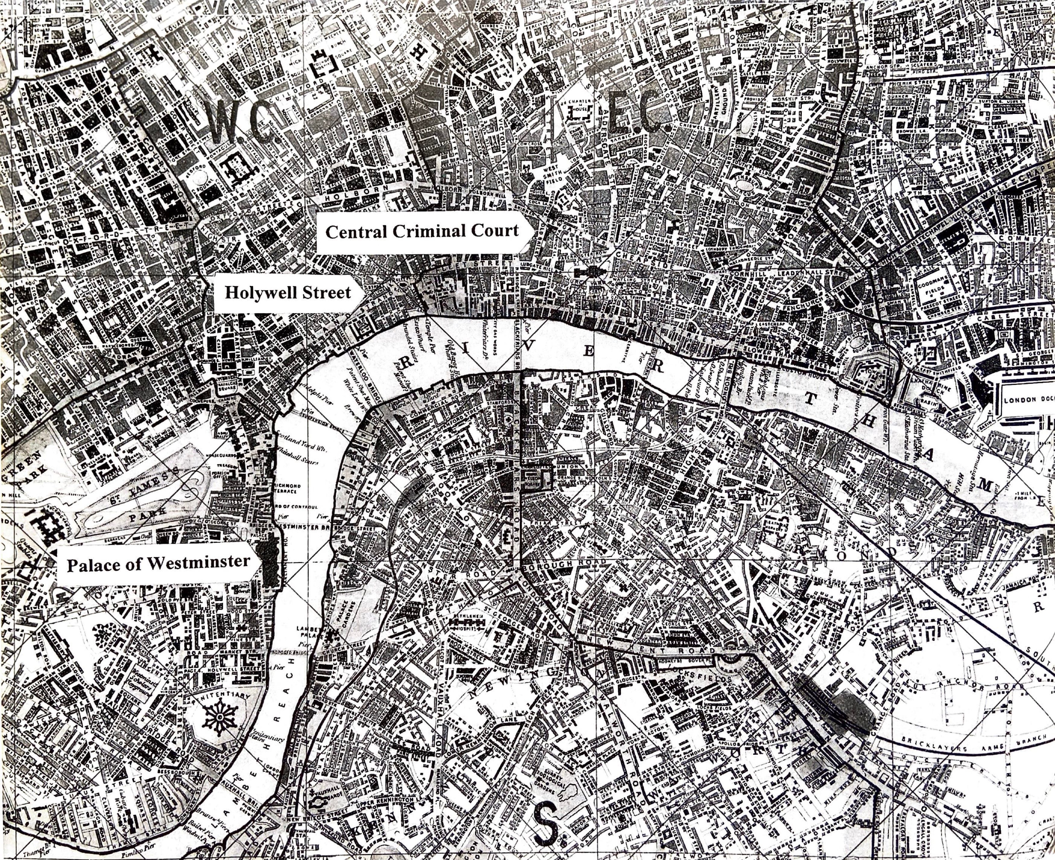
Annotated section of Whitbread's New Plan of London: Drawn from Authentic Surveys ( London: J. Whitbread, 1857). Showing the topographical relationship of the Palace of Westminster, Holywell Street and the Central Criminal Court.
"If one of the central ideals of urban improvement in the nineteenth century was the flow of movement, then Holywell Street was an impenetrable congestion, obstructing the main thoroughfare and line of communication between the City of London and Westminster. Topographically, Holywell Street lay at the mid-point on a route that linked the Houses of Parliament in Westminster and the criminal courts at the Old Bailey in the City of London. These highly symbolic sites marked the spatial beginning and end of law: the place of the framing of legislation and the place of its enactment. Holywell Street's transgressive space interfered with the linear, hierarchical vision of law. It was a place of desire and resistance, in which space itself assumed political dimension. "